
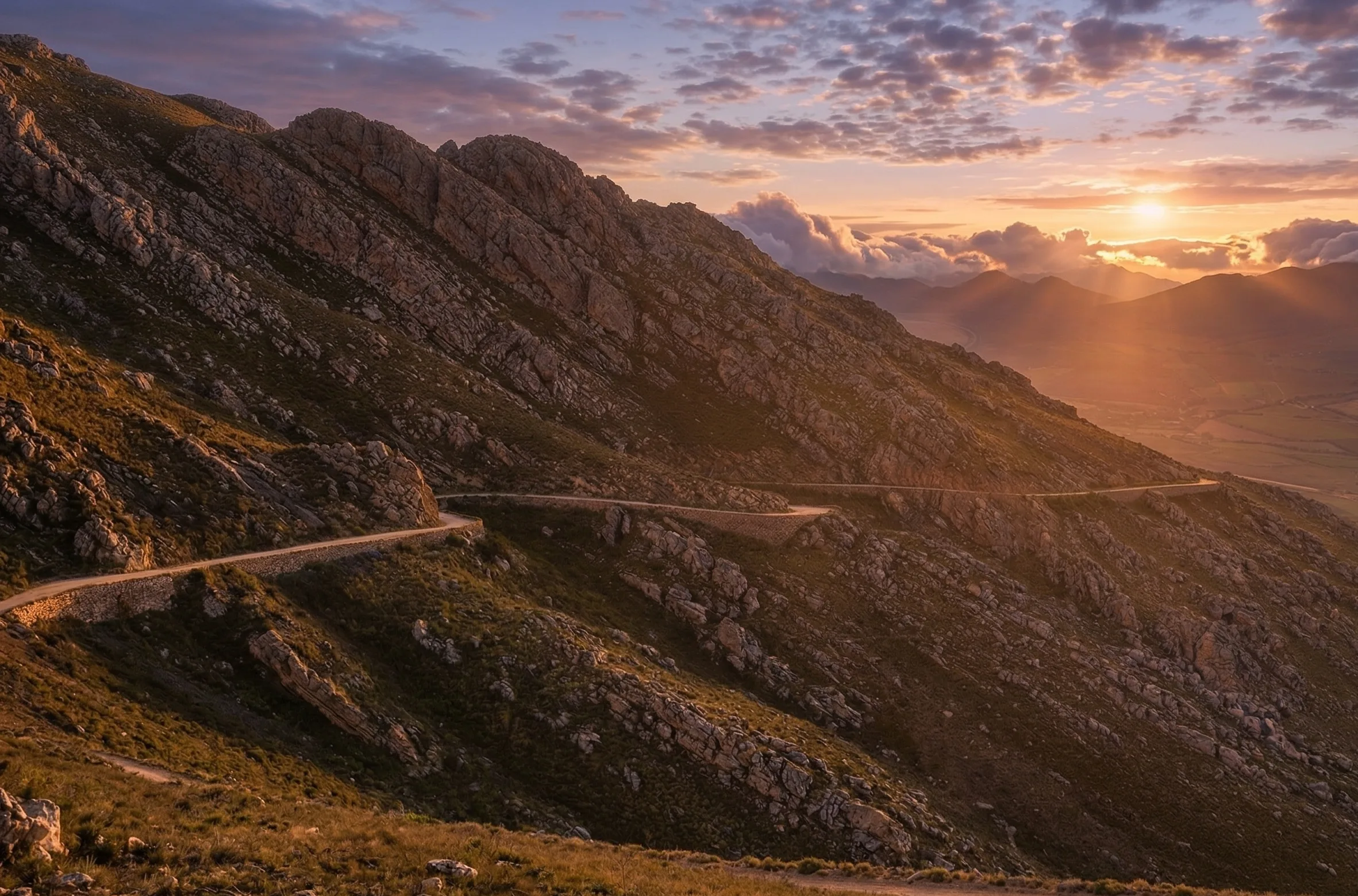
The Swartberg Pass is a 27-kilometre gravel road that climbs 1,585 metres through one of the most dramatic mountain crossings in South Africa. Built by Thomas Bain between 1881 and 1888 and now a UNESCO World Heritage Site, it connects Oudtshoorn to Prince Albert in 1.5 hours of driving. This guide covers timing, named stops, vehicle requirements, the Die Hel detour, where to refuel and where to eat at the end of the pass.
SWARTBERG PASS AT A GLANCE
Drive time over the pass: 1.5 hours (Oudtshoorn to Prince Albert)
From Cape Town: 4 hours 20 minutes / 415 km via Route 62
Pass length: 27 km of gravel
Highest point: Die Top, 1,585 metres above sea level
Vehicle: Reasonable ground clearance recommended. 4×4 not required. No caravans or heavy vehicles.
Fuel: Fill up at Oudtshoorn or Prince Albert. No fuel on the pass itself.
Lunch: Cafe O at Swartrivier Farm, four kilometres from Prince Albert on the Karoo side.
Best months: April-May or September-October. Snow can close the pass in winter.
How long does the Swartberg Pass take?
Allow 1.5 hours for the crossing itself, plus stopping time for photographs and viewpoints. Most travellers spend 2 to 2.5 hours from one side to the other, including a short stop at Die Top.
From Cape Town, the full journey to Prince Albert via the Swartberg Pass takes around 6 hours of driving across two routes: the N1 north to Worcester and Touws River, or the more scenic Route 62 through the Klein Karoo. Route 62 adds about 30 minutes but turns the trip into the road trip itself.
Getting there from Cape Town
The Swartberg Pass is approximately 415 kilometres from Cape Town. There are two approaches: via the N1 and R407 through the Karoo to Prince Albert, arriving at the northern side; or via Route 62 through Robertson, Montagu and Barrydale to Oudtshoorn, arriving at the southern side. Both routes are scenic, but approaching from Prince Albert puts you at the quieter end of the pass with the Karoo stretching out behind you.
Most travellers prefer the Route 62 approach on the way out and the N1 on the return, or the reverse, so they see both Karoo landscapes.
Named stops along the pass with timing
The pass has a series of historically named stops, many dating back to the construction era. From the southern (Oudtshoorn) side, working north towards Prince Albert:
- Eerstewater (10 minutes from Oudtshoorn): Bain established his first convict base camp here. The ruins are still visible.
- Die Groot Klip (25 minutes in): Popular viewpoint where the summit first comes into sight.
- Malvadraai or Geranium Bend (35 minutes in): Wild geraniums grow in a natural inlet. One of the Swartberg’s finest hiking trails begins here.
- Blikstasie (40 minutes in): The stone and clay structure built to confine convicts at night. The ruins remain.
- Die Top (1 hour in, 1,585 m): The windswept summit with its famous signpost. Panoramic views over the Great Karoo to the north and the Klein Karoo to the south. Most travellers spend 15 to 20 minutes here.
- Descent into Prince Albert (1.5 hours total): The northern descent winds through fynbos slopes into the Karoo plain.
There are four official picnic sites and viewpoints on the southern ascent. Each offers a different perspective of the folded mountain geology and the fynbos vegetation that covers the upper slopes.
Vehicle requirements and fuel
The pass is entirely untarred. The road surface is compacted gravel with some rocky sections, and the maximum gradient is 1:8. A 4×4 is not required, but a vehicle with reasonable ground clearance is strongly recommended. Most modern sedans can manage in dry conditions, but small low-slung cars will struggle. No heavy vehicles, buses or caravans are permitted.
Fill up with fuel in either Prince Albert or Oudtshoorn. There are no stations on the pass itself, and the last 80 kilometres before Prince Albert from the N1 side has no fuel either. A tank of half full or better is the right starting point.
The history behind the road
Thomas Bain was commissioned to plan the route in 1879. Construction began in 1881 from the Prince Albert side, initially using 100 labourers from Mozambique under a private contractor. After just six kilometres in thirteen months the contractor went insolvent and work halted for a year. Bain took over personally in November 1883 with 200 to 240 convicts and completed the pass in 1888, his final and finest piece of road engineering. The distinctive dry-stone retaining walls he built still stand more than 130 years later.
Die Hel: the detour worth considering
A turnoff from the Swartberg Pass road leads to Gamkaskloof, known as Die Hel: a 20-kilometre valley deep in the Swartberg range that was home to one of the most isolated communities on the sub-continent for 150 years. The name likely derives from the Afrikaans word “helling” meaning steep incline, not from any infernal association. The drive is 55 kilometres of gravel and requires a high-clearance vehicle. Annetjie Joubert, a native of the valley, still runs a private lodge and restaurant on her family farm.
The Die Hel detour adds at least four hours to the trip and is best done as an overnight stop rather than a return drive in one day.
Where to eat after the Swartberg Pass
After descending into Prince Albert, most travellers are ready for a long lunch and a slow afternoon. The town has more good food than its size suggests.
Four kilometres from town on Kruidfontein Road, Cafe O at Swartrivier Farm serves light lunches, tapas, wood-fired pizzas and coffee surrounded by working olive groves. The same farm offers olive tastings and guided tours through the groves, sorting tables and olive press, which pair naturally with the mountain drive. Cafe O is open Wednesday to Sunday for lunch.
In the village itself, Karoo Kombuis is a 24-year Karoo institution and a TripAdvisor favourite, Lazy Lizard captures Swartberg Pass tourist traffic with a relaxed bistro menu, and Jeremy’s offers a fine-dining option for evenings. For a deeper guide to dining in town, see our Prince Albert restaurants guide.
The Swartberg Circle Route
For travellers with a full day, the Swartberg Circle Route combines the Swartberg Pass with Meiringspoort, a 25-kilometre tarred road through a natural gorge on the N12 between De Rust and Prince Albert. The loop runs Oudtshoorn to Prince Albert over the Swartberg Pass, then Prince Albert to De Rust through Meiringspoort, and back to Oudtshoorn. It can be started from any of the four towns. Total drive time is about 4 hours of driving, plus stops.
Safety tips
Check local road conditions before departure, particularly after heavy rain or in winter when snow can close the pass. Reduce tyre pressure slightly for better grip on gravel. Use engine braking on steep descents rather than riding the brakes. Give way to uphill traffic on narrow single-lane sections. Bring water and snacks. The best months for driving are April and May or September and October, when temperatures are moderate and the wildflowers on the upper slopes may be in bloom.
The Swartberg Mountains harbour approximately 20 percent of the African continent’s plant diversity, including endemic species of protea and fynbos found nowhere else on earth. Whether you are driving the pass for the views, the history or the sheer thrill of the road, it is one of the Western Cape’s most rewarding day trips.
Frequently asked questions
How long does the Swartberg Pass take?
1.5 hours of pure driving for the 27-kilometre crossing. Most travellers spend 2 to 2.5 hours including a short stop at Die Top and the named viewpoints.
Can I drive Swartberg Pass in a sedan?
Yes, in dry conditions and with reasonable ground clearance. A 4×4 is not required. Avoid the pass after heavy rain or in winter snow conditions. Small low-slung sports cars will struggle on the rougher sections.
Where do I refuel before the Swartberg Pass?
Fill up at Oudtshoorn on the southern side or Prince Albert on the northern side. There are no fuel stations on the pass itself. From the N1, the last 80 km into Prince Albert has no fuel either, so leave the highway with at least half a tank.
Where do I eat in Prince Albert after the Pass?
Cafe O at Swartrivier Farm, four kilometres from town, serves light lunches, tapas and wood-fired pizzas surrounded by working olive groves. The same farm offers olive tastings and farm tours, which pair naturally with the mountain drive. Other options in the village include Karoo Kombuis, Lazy Lizard and Jeremy’s.
Is the Swartberg Pass safe in winter?
The pass occasionally closes after heavy snow in June, July and August. Check road conditions before departure. The summer months (December to February) are very hot but the pass remains open. The most comfortable months are April-May and September-October.
What is Die Hel?
Die Hel, also known as Gamkaskloof, is a 20-kilometre valley reached by a 55-kilometre gravel road branching off the Swartberg Pass. It was home to one of South Africa’s most isolated communities for 150 years until the road was built in 1962. The detour adds at least four hours to the trip and is usually done as an overnight stop.
Plan your stop at O for Olive after the Pass: olive tasting, farm tour and lunch at Cafe O, four kilometres from Prince Albert on Swartrivier Farm. True Karoo Magic at the end of one of the most dramatic mountain drives in the country.